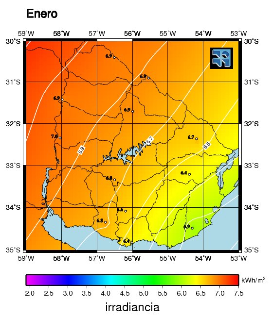
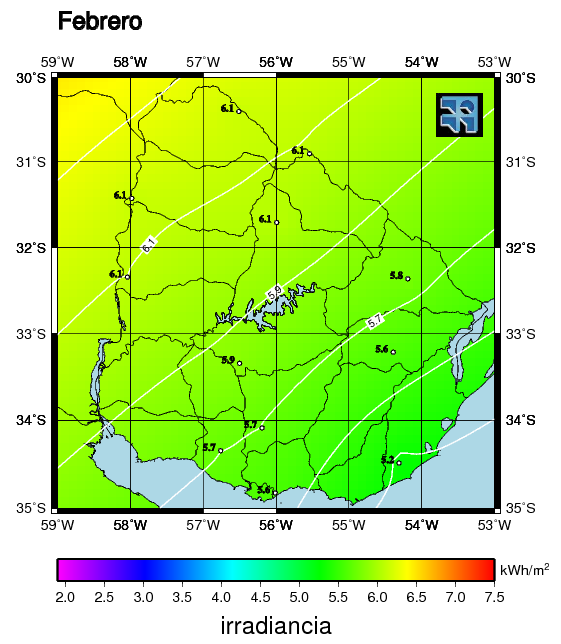
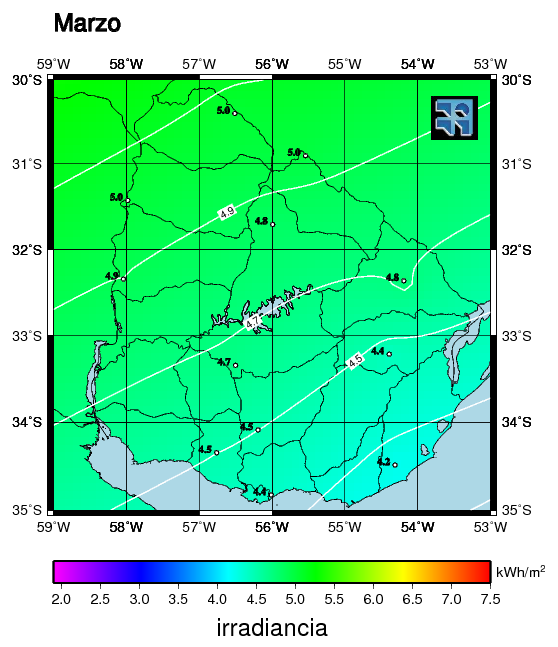
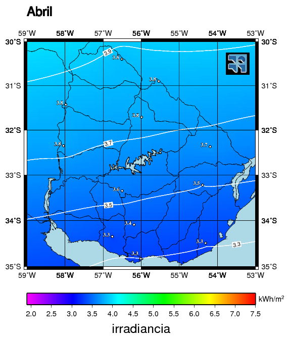
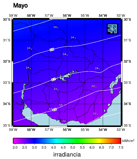
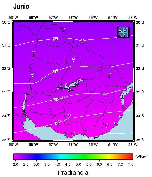
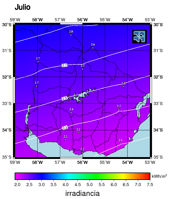
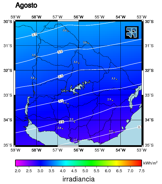
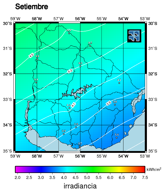
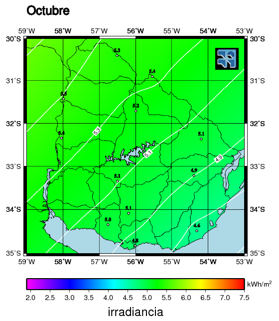
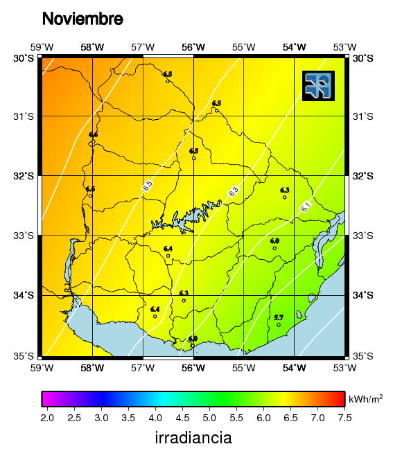
Solar Map of Uruguay v1.0 (May 2009): In 2008, with the support of the Energy Efficiency Project (DNE/MIEM), the Faculty of Engineering carried out the first survey of the solar resource on a national scale. As a result of this effort, in 2009 the first version of the Solar Map of Uruguay (MSUv1) was published.
The Solar Map is not something static, but must be considered as an incremental process aimed at a continuous improvement in the knowledge of solar resources in Uruguay. A second version of the Solar Map was released in 2017, based on ground measurements and GOES-East satellite images.

- Monthly averages of daily stored in kilowatt-hours per square meter.
- Click on each map to enlarge.
Technical documents
- Technical Report of the Solar Map of Uruguay. (Ed. UdelaR 2011)
published by CSIC-UDELAR: PDF, 7.2 Mb, in Spanish - MSU public presentation: (April 2009)
- Summary publication in CLA-ISES 2010 Congress (PDF, 2.9 Mb, Spanish)

