In 2010, the LES developed a satellite model for solar resource estimation, specially adapted to the characteristics of Uruguay. This was the first model to be locally implemented and was fitted using data from the measurement network. The model has been refined over time in order to successively improve the quality of its estimates: being to date a 13% on an hourly scale, 5.5% on a daily scale and 4% on a monthly scale. On a daily and superior scale, the uncertainty of the model is indistinguishable from the uncertainty of a field instrument.
Related publications: here and here.
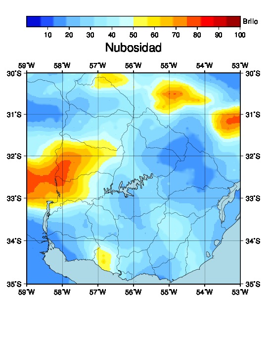
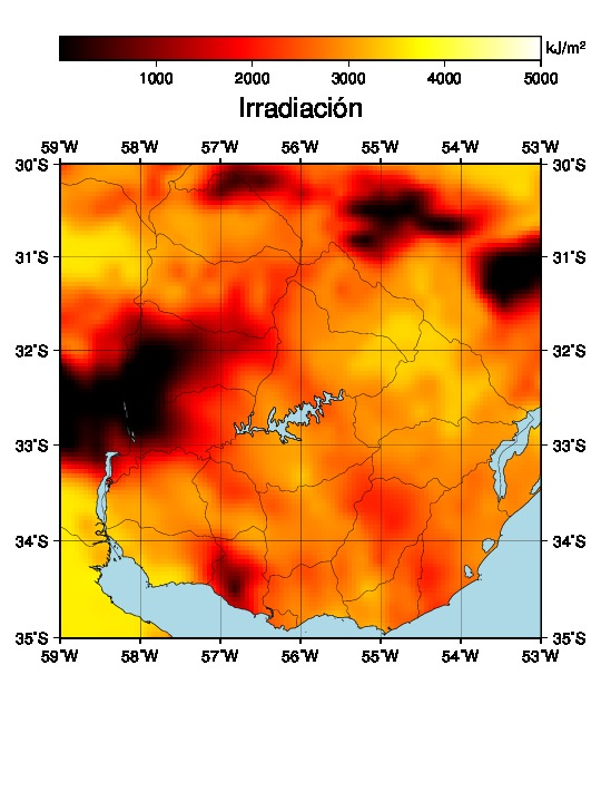
The model uses images from the GOES satellite to generate hourly solar irradiation estimates. A database with satellite images of Uruguay has been created, which has information from the year 2000 to date, and has a frequency of two images per hour on average. Therefore, it is possible to provide hourly satellite irradiation data from the year 2000 to current date for any point within the national territory. From a satellite image a variable representing the cloudiness level is estimated, which is used to generate the solar radiation estimate at ground level. The following figure shows how it works: the higher the brightness observed in the satellite image, the greater the cloudiness and, therefore, the less irradiation. The image shown here is the spatial distribution of solar irradiation for a certain date and time, and it is not a long-term mapping of the resource.
In accordance with the general policy of the LES, this satellite data is provided free of charge for research, teaching or non-profit activities. In any other case, they have an associated cost depending on the placed request. Requests for estimates and/or inquiries for information can be made through our contact form.